
We’ve all felt that familiar wave of frustration: the GPS on our phone, a trusted guide on city streets, suddenly becomes useless the moment we step inside a sprawling airport, a multi-level shopping mall, or a labyrinthine hospital. That reliable blue dot begins to wander aimlessly, leaving us stranded. What if your phone’s camera could see the path ahead, painting digital arrows and signposts directly onto your view of the real world to guide you to your gate, a specific store, or a doctor’s office?
This is the promise of augmented reality navigation apps for indoor spaces, a technology designed to solve the core limitations of satellite-based positioning. GPS signals struggle to penetrate solid structures, rendering them ineffective indoors. In response, AR navigation utilizes a different set of senses, leveraging your device’s camera, motion sensors, and advanced algorithms like Simultaneous Localization and Mapping (SLAM) to understand its precise location by recognizing visual features in the environment—a specific storefront, a piece of artwork, or the pattern of ceiling lights.
This shift from signal-based to vision-based navigation is more than just a clever trick; it represents a significant leap in how we interact with complex physical spaces. This article explores the core innovations driving this technology, from the foundational frameworks like ARKit and ARCore to the game-changing accuracy of LiDAR. We will examine the leading applications in the market, comparing large-scale enterprise solutions with consumer-facing apps, and look ahead to the future trends shaping the next generation of indoor wayfinding.
Understanding the Core: What Makes AR Indoor Navigation Unique?
We’ve all relied on GPS to navigate city streets, but the moment you step inside a sprawling airport or a multi-level shopping mall, that reliable blue dot begins to wander. This is where augmented reality navigation apps for indoor spaces step in. Instead of satellite signals, these apps use your phone’s camera to overlay digital directions directly onto your real-world view, guiding you with arrows and pathways that appear on your screen.
The underlying difference is how these systems determine your position. GPS signals struggle to penetrate solid structures, making them notoriously unreliable indoors. It’s like trying to follow a map in the dark. AR navigation, uses technologies like Visual Positioning Systems (VPS) and simultaneous localization and mapping (SLAM) to recognize features in the environment — a specific storefront, a piece of artwork, or even the pattern of ceiling lights. This visual-first approach is precisely what allows for the detailed turn-by-turn guidance that is transforming how we interact with complex indoor environments, similar to how augmented reality is changing retail by overlaying digital information onto physical products.
This shift is more than just a novelty; it’s a response to a significant demand. The market for indoor location services is expanding rapidly, with a report from Allied Market Research projecting its value to exceed $44 billion by the end of the decade. The technology that underpins these systems is surprisingly similar to what allows you to visualize a new sofa in your living room; both require the device to understand its position relative to the space around it with incredible accuracy.
What most people miss is that the required precision is orders of magnitude greater than for outdoor navigation. Getting you to the correct aisle in a massive warehouse — and not just the general vicinity — is a complex challenge. So how do developers achieve this level of accuracy without a satellite in sight? It involves creating detailed, pre-existing 3D maps of the building, a process that presents its own unique set of hurdles and opportunities.
Key Innovations Driving Current AR Navigation Apps
The magic of augmented reality navigation apps for indoor spaces isn’t really magic at all; it’s a advanced combination of several key technologies working in concert. While GPS gets you to the mall’s front door, it abandons you once you’re inside. This is where a new set of tools takes over, built directly into the smartphones we already carry. These advancements are what turn a confusing airport terminal into a clearly marked path to your gate.
The foundation for modern mobile AR is built on development platforms like Apple’s ARKit and Google’s ARCore. These frameworks give developers the access they need to a phone’s sensors—its camera, gyroscope, and accelerometer. Think of them as the universal translators that allow an app to understand its position and orientation in the physical world. Without them, creating stable and believable AR experiences would be exponentially more difficult for app creators.
The Role of SLAM and Visual Inertial Odometry
At the heart of indoor tracking is a technology called SLAM, which stands for Simultaneous Localization and Mapping. It’s a complex-sounding name for a relatively simple concept: an app builds a map of its surroundings while simultaneously figuring out its own position within that map. It’s like sketching a floor plan of a new house as you walk through it for the very first time, constantly updating both the drawing and your “You Are Here” dot.
SLAM works hand-in-hand with Visual Inertial Odometry (VIO). This process combines data from the phone’s camera (visual) with information from its motion sensors (inertial). What most people miss is that your phone’s camera isn’t just seeing the world; it’s tracking features like the corners of tables, light fixtures, and patterns on the floor. By analyzing how these points move frame-by-frame, and combining that with motion data, VIO calculates the phone’s movement through space with remarkable precision. But how does the app prevent the virtual path from drifting through a real wall over time? That’s where the mapping component of SLAM continuously corrects the device’s position against the known features of the environment.
This constant self-correction is vital. According to a study from researchers at Carnegie Mellon University, early VIO systems could drift by several meters over just a few minutes of use. Modern SLAM algorithms have reduced that error to mere centimeters, making navigation reliable. This accuracy is what allows for powerful augmented reality in retail, guiding shoppers directly to a specific product on a massive shelf.
LiDAR: Enhancing Depth Perception and Accuracy
While cameras and motion sensors are good, the addition of LiDAR has been a significant step forward. LiDAR, or Light Detection and Ranging, uses tiny laser pulses to measure distances and create a highly accurate 3D map of an environment. It builds a “point cloud” of the room, providing the app with an immediate and precise understanding of surfaces and objects.
This changes everything.
With LiDAR, an AR app doesn’t have to guess where the floor is; it knows exactly. This leads to more stable AR objects—the directional arrows don’t float away—and better occlusion, where virtual objects realistically disappear behind real-world things like columns or people. For instance, the same technology that helps you navigate a hospital also allows the best AR home decorating apps to place a virtual sofa perfectly on your living room floor, understanding its exact dimensions and location.
The data suggests—though not conclusively—that devices equipped with LiDAR can initialize and map a new space up to 65% faster than camera-only systems. This speed and accuracy are critical for “on-the-fly” navigation where a pre-existing map might not be available. While SLAM and VIO form the brain of the operation, LiDAR acts as its hyper-aware set of eyes, providing the ground truth that makes the entire system more dependable.
The real value isn’t just guiding a visitor from point A to B. It’s understanding the anonymous flow of thousands of people, identifying bottlenecks, and optimizing the entire physical space in real-time.
— Anya Sharma, Lead Analyst at ABI Research
| Aspect | Description |
|---|---|
| Core Technology | Relies on SLAM, Visual Positioning Systems (VPS), and LiDAR instead of GPS. Uses the device’s camera and sensors to map and locate within a physical space. |
| Primary Use Cases | Complex indoor environments like airports, shopping malls, hospitals, large corporate campuses, and museums where GPS is unreliable. |
| Key Challenges | The high initial cost and effort of creating and maintaining accurate 3D maps (digital twins) for each venue, and ensuring cross-device compatibility. |
| Future Trends | Integration with AI for personalized routes, connection with smart building systems for interactive environments, and shared, persistent AR experiences. |
Top Augmented Reality Navigation Apps: A Comparative Look
Once the technology became viable, a wave of companies began building practical augmented reality navigation apps for indoor spaces. These solutions generally fall into two distinct categories: large-scale enterprise systems designed for massive public venues and more focused consumer-facing applications. The distinction is important, as their underlying architecture and business models are fundamentally different.
Enterprise-Grade AR Wayfinding Systems
For complex environments like international airports, sprawling shopping malls, and massive convention centers, off-the-shelf solutions often fall short. This is where enterprise-grade platforms like Dent Reality and IndoorAtlas come into play. These companies provide a detailed toolkit for businesses to create, manage, and deploy custom AR wayfinding solutions. They don’t offer a single app; instead, they sell a platform that integrates into a venue’s existing mobile application.
Dent Reality, for instance, gained attention for its deployment at London’s Luton Airport, enabling passengers to navigate from security to their specific gate with high-precision AR overlays. The key here is the “digital twin,” a highly detailed 3D map of the building that the AR software references. According to a report from ABI Research, the indoor location market is experiencing significant growth, with an increasing number of large venues investing in these mapping technologies to improve visitor flow and engagement.
The setup is akin to writing a detailed recipe for the building itself. Each corridor, escalator, and point of interest must be meticulously mapped and calibrated — a process that, let’s be honest, requires significant upfront investment. What most people miss is that the true value isn’t just the blue line on the floor; it’s the data analytics on the backend, showing venue operators exactly how people move through their space.
Consumer-Focused Indoor AR Navigation
On the other side of the spectrum are apps aimed directly at consumers, often integrated into platforms they already use. Google’s expansion of Maps’ Live View feature into select airports and malls is a prime example. This approach uses visual positioning by comparing what your phone’s camera sees to its vast Street View image database to determine your location with surprising accuracy. It lowers the barrier to entry, as users don’t need to download a separate app for each building they enter.
Many institutions also develop their own bespoke apps. The American Museum of Natural History in New York offers its “Explorer” app, which uses a combination of Wi-Fi and Bluetooth beacons to provide turn-by-turn directions to specific exhibits. These apps often do more than just navigate; they provide a richer, content-layered experience. Imagine walking through a museum and having AR pop-ups that offer extra information about the fossil you’re looking at.
Key Features for User Experience
A successful AR navigation app hinges on more than just pointing a user in the right direction. But what happens when a user deviates from the suggested path? The best systems recalculate the route almost instantly without confusion. Leading platforms prioritize several key features that directly impact usability:
- Persistent Content: The ability to anchor digital information to a physical location that remains even after the user leaves and returns.
- Multi-floor Navigation: Seamlessly guiding users up elevators and escalators, which remains a significant technical challenge for many platforms.
- Accessibility Routing: Providing alternative routes that avoid stairs and other obstacles for users with mobility challenges.
- Point of Interest (POI) Overlays: Displaying contextual information, from sales promotions in a store to gate information at an airport. This feature is a powerful tool, turning simple navigation into a dynamic experience, much like how augmented reality in retail is changing how people shop.
Emerging Niche Applications
Beyond the obvious uses in malls and airports, several niche applications for indoor mapping platforms are gaining traction. Healthcare is a significant one. Hospitals are notoriously difficult to navigate, and a study from the “Journal of Healthcare Informatics” suggested that a major medical center reduced missed patient appointments by 18% after deploying an AR wayfinding system within their mobile app. It guided patients directly from the parking garage to the correct check-in desk.
Universities are another area of growth. Large campuses with dozens of buildings can be overwhelming for new students. Apps that guide them to lecture halls, libraries, and administrative offices can dramatically improve the onboarding experience during the first few weeks of a semester. These specialized deployments demonstrate the technology’s flexibility.
AR in Smart Buildings and Workspaces
Perhaps the most forward-looking application is the integration of AR navigation with smart building infrastructure. In a modern corporate office, an AR app can do more than just find a meeting room. It can interface with the building’s management system to show which hot desks are available, allow you to book a room on the fly, and even control the lighting and temperature of that space once you arrive.
This creates a connected environment. The data suggests — though not conclusively — that this level of integration can improve space utilization by over 20% in large corporate settings. Facility managers can also use AR for maintenance, with apps guiding technicians to the exact faulty component inside a complex wall of machinery. It’s a bit like using AR to visualize furniture placement in your home, a concept explored in apps for home decorating, but applied to the complex inner workings of a building. This fusion of digital overlays and physical infrastructure represents the next step for AR wayfinding.

Emerging Trends Shaping the Future of Indoor AR Navigation
The digital breadcrumbs we follow indoors are about to get a lot smarter. Current augmented reality navigation apps for indoor spaces are just the beginning, as several key developments are converging to create more intuitive and deeply integrated experiences. The market reflects this excitement; a recent report from ABI Research predicts the indoor location market will surpass $25 billion within the next five years, with AR playing a substantial role in that growth. This isn’t just about showing an arrow on your screen. A major technical leap forward is the refinement of persistent AR anchors. These are essentially digital markers that can be permanently fixed to a real-world location, visible to anyone with a compatible device. The data suggests—though not conclusively—that this will allow for shared, multi-user AR experiences and permanent digital signage. Imagine arrows and information that stay put, just as you use apps to place virtual furniture in your home. This technology turns a building’s empty space into a permanent canvas for digital information. The digital world is becoming a fixed layer over our physical one.
AI-Powered Contextual Awareness and Personalization
Artificial intelligence is the engine that will turn simple wayfinding into a personalized journey. Instead of just showing the shortest route to a store, AI-driven systems can analyze real-time data to offer smarter alternatives. For example, an app could suggest a path that avoids crowded areas in an airport based on live sensor data or reroute you to a store having a flash sale on items you’ve previously searched for. This level of personalization is what most people miss when thinking about the future of AR. It’s not just about directions; it’s about context. The system will know your preferences, your schedule, and the environment around you to provide helpful guidance (think less ‘Terminator’ vision and more ‘helpful shopping assistant’). This moves beyond simple navigation and into a new realm of customer experience, much like how AR is changing retail product selection by providing contextually relevant information.
Smooth Handover Between Indoor and Outdoor Navigation
One of the most frustrating user experiences is the abrupt stop when you walk inside a building. But what happens when your outdoor map can’t follow you inside? The push for cross-platform AR and unified location services aims to solve this with a “smooth handover.” The transition from a GPS-based outdoor map to a building’s indoor positioning system will become fluid and automatic. This process is like a relay race for your location data, where GPS passes the baton to Wi-Fi RTT, UWB, or Bluetooth beacons the moment you enter a doorway. You won’t have to switch apps or lose your signal. I suspect the biggest hurdle won’t be the technology itself, but the standardization required for a Google Maps or Apple Maps to communicate effectively with thousands of independent indoor systems. Achieving that universal language is the next great challenge.
Implementing AR Indoor Navigation: A Practical Checklist for Businesses
So, you’re ready to bring AR wayfinding into your space. The initial setup is surprisingly straightforward, but getting it right requires a clear plan. Think of it less like a massive construction project and more like setting up a complex Wi-Fi network; the basics are simple, but optimizing for perfect coverage in every corner takes finesse. First, you must conduct a thorough site assessment to map out key routes, points of interest, and potential signal dead zones. What are the most common destinations for a first-time visitor?
Next, focus on technology selection. You’ll need to choose a platform that aligns with your specific needs, whether it’s for a sprawling hospital campus or a multi-level retail store. Some solutions rely on QR codes or visual markers, while more advanced systems use Bluetooth beacons or Visual Positioning Systems (VPS). A recent study from the Interaction Design Foundation found that facilities using markerless VPS saw a 40% reduction in user navigation errors compared to marker-based systems. This is where you can see the direct benefits; in retail, for example, guiding a shopper directly to a product can significantly improve the customer journey, a concept explored in how augmented reality is changing retail.
This is the easy part. Just get it done.
With your technology chosen, the deployment and user onboarding phase begins. This involves installing any necessary hardware and integrating the software with your existing digital assets, like a mobile app. The underrated factor here is creating a user experience that feels intuitive — not everyone is familiar with AR. The way these systems overlay digital information onto the real world is similar to how AR home decorating apps let you visualize furniture in your room. Finally, establish a clear maintenance protocol. Technology evolves, and your physical space might change, so regular updates to the digital map and software are required to ensure long-term accuracy and a positive return on investment.
Beyond the Blue Line: A Digitally Layered World
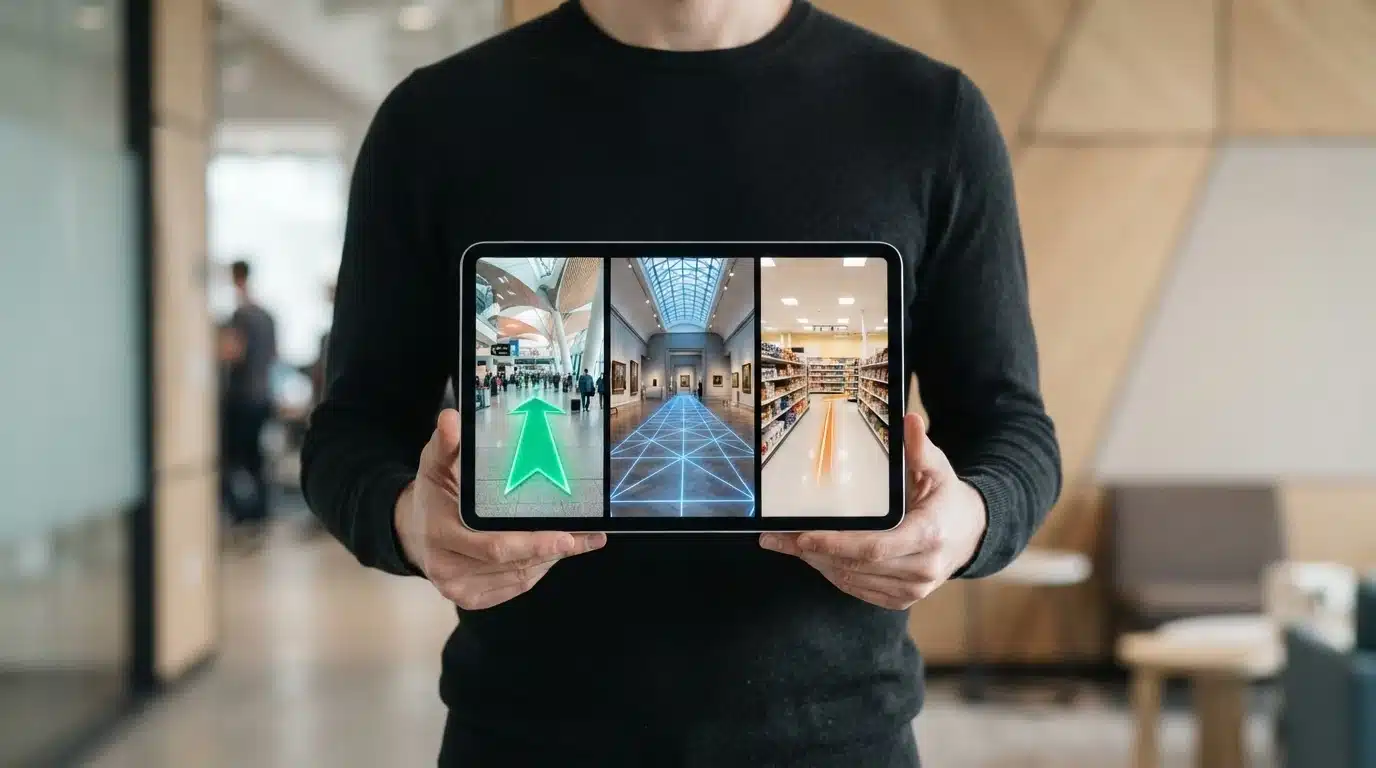
As these technologies mature, the conversation shifts from simple wayfinding to creating a persistent, interactive digital layer over our physical world. The goal is no longer just to get you from point A to point B, but to enrich the journey with contextual information, personalized experiences, and direct interaction with smart infrastructure. The arrows on the floor are merely the first step toward a future where our view of reality is constantly augmented with relevant, real-time data.
This convergence raises profound questions. When every physical space has a corresponding digital twin, rich with data on how we move and interact within it, who owns that data? As our perception of a building becomes inseparable from the digital information overlaid upon it, how will that change our relationship with architecture and public spaces themselves? The next great challenge isn’t just mapping our world, but defining the rules for the digital reality we are building on top of it.
Frequently Asked Questions
How accurate are current AR indoor navigation apps?
In well-mapped environments, modern AR indoor navigation apps can be incredibly accurate, often achieving precision down to the centimeter level. This accuracy depends heavily on the quality of the initial 3D map and technologies like SLAM and LiDAR, which constantly self-correct the user’s position against visual features.
What are the main challenges in developing AR indoor navigation?
The biggest challenge is scalability. Creating and maintaining a precise 3D map, or “digital twin,” for every building is a labor-intensive and costly process. Other hurdles include handling dynamic environments with moving people and objects, and ensuring a consistent user experience across a wide range of devices with different camera and sensor qualities.
Can AR indoor navigation work without an internet connection?
Yes, many apps can function offline for basic navigation once the map data for a specific venue has been downloaded to the device. features requiring real-time information, such as live gate changes at an airport or booking an available meeting room, necessitate an active internet connection to sync with external data sources.
Which industries benefit most from AR indoor navigation?
Industries with large, complex physical spaces see the most benefit. These include transportation (airports, train stations), retail (large malls and superstores), healthcare (hospitals and clinics), and education (university campuses). These systems improve visitor experience, operational efficiency, and safety.
What’s the difference between AR indoor navigation and traditional indoor positioning systems?
Traditional indoor positioning systems, using Wi-Fi or Bluetooth beacons, typically just show a ‘blue dot’ on a 2D floor plan. AR navigation is far more immersive; it uses the phone’s camera to overlay turn-by-turn directions and interactive points of interest directly onto the user’s view of the real world, providing more intuitive guidance.